
LATEST ARTICLES
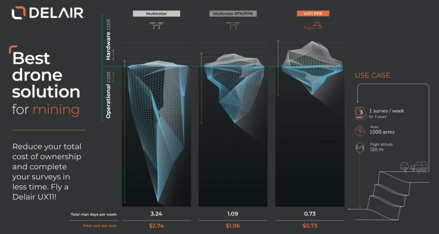
How much does it cost to operate drones in mines? The operational costs associated with having a qualified surveyor to perform the work with a drone must not be underestimated, because as the old saying goes, time is money.
Read more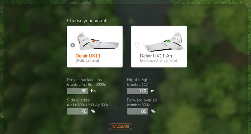
How to quickly estimate the time it takes to conduct a drone survey? The Delair UX11 Project Calculator is a simple online tool that estimates key factors that are useful for planning and budgeting for an aerial survey.
Read more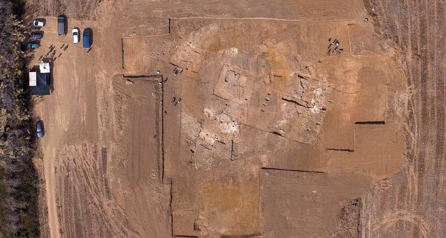
Archaeological Surveys Drone: learn more about how ATS improved their archaeological surveys with the Delair UX11 fixed-wing drone, through an innovative approach to maximizing effectiveness, efficiency and cost-effectiveness.
Read more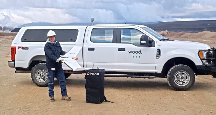
For large-scale surveying and asset management in remote areas, drone-based data collection is often the only option. Engineering services company Wood realized the advantages of a fixed-wing UAV platform from Delair for efficiently collecting critical data to plan and manage a mining operation in the Western US.
Read more
Learn how you can get consistent UAV orthophoto resolution thanks to precise terrain following and use of custom digital elevation models.
Read more