Business Solutions
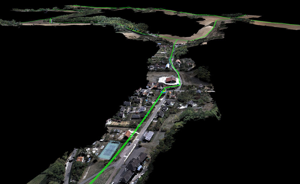
Linear & Infrastructure Solutions
Our experience and close partnerships with major electric transmission and distribution companies have resulted in industrialized and proven solutions that meet the specific requirements of the electric power industry. RTE, the French power transmission company, has been using our systems for several years to inspect and digitize their power lines.
Advanced mission planning tools for corridor mapping in Delair Flight Deck Pro and the incredible extended communications range with the Delair Xtreme Link or the Delair Cellular communication link make Delair an ideal choice for any asset manager or subcontractor working on linear infrastructure.
- Electric power utilities – powerline inspections, vegetation encroachment, environmental permitting, new line planning
- Oil and Gas – pipeline inspections, mapping and permitting for new pipelines
- Rail – rail line inspections, subsidence monitoring, risk and hazard mapping
- Road and highway – topography, cut and fill, volume calculations, material estimating when bidding on new projects, construction project monitoring during earth work, as-builts
- Transportation – metro and public transit planning, Right of Way, access planning
- Telecommunications – fiber optic route planning
- Environmental monitoring – mapping riparian areas, wetland delineation, new infrastructure site mapping for environmental impact assessments
Combined with Alteia platform, or your data analytics platform of choice, Delair drones provide a complete view of your infrastructure’s condition. This enables informed decisions and powerful management and maintenance plans.
With down to 1cm GSD, the Delair UX11 can inspect or map 20 km (12 mi) of a linear asset in a single out-and-back flight using its revolutionary 3G/4G cellular communication link.
With features like live mapping. terrain following, and custom waypoints, Delair drones are sure to provide you with both the performance and the peace of mind you need to scale up your drone operations.

Solutions.
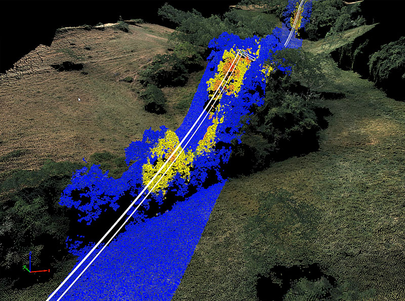
Vegetation encroachment analysis
Powerline inspection and mapping
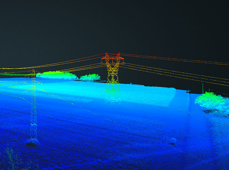
Vectorized Conductors
Delair makes the ultimate digital twin data collection drones for linear infrastructure.