Delair
  • PRODUCTS
    • DELAIR DRONES
      • UX11
        • DELAIR UX11
      • DT26 LINE
        • DT26E SURVEILLANCE
        • DT26E TACTICAL
        • DT26E OPEN PAYLOAD
        • HYDRONE
      • DT46 line
        • DT46
        • DT46 LiDAR
      • DT61
      • CROW
      • Underwater drone SEASAM
    • Universal Ground Control Station – DRAKO
  • APPLICATIONS
    • SECURITY AND DEFENSE
    • LINEAR & INFRASTRUCTURES
    • GEOSPATIAL
  • MANUFACTURING & SUPPORT
  • ABOUT US
    • JOB OPPORTUNITIES
    • CONTACT US
  • NEWS
    • PRESS BOOK
    • PRESS RELEASES
    • Newsletter
  • SUPPORT
  • Surveying & Mapping
  • Mines & Aggregates
  • Power & Utilities
  • Oil & Gas
  • Success Stories
  • News

certified-bvlos-drone-ux11

Delair receives first official European Union authorization for BVLOS drone operations with the UX11 UAS

19 June 2020 READ MORE The European Union, through the EASA (European Union Aviation Safety Agency), has implemented the first union-wide regulations for drone operations, including the first rules for BVLOS (Beyond Visual Line Of Sight) flights. Delair is amongst the first companies to receive the EU BVLOS certification, which...

Delair Flight Deck Pro 6. 0.13.15 Beta - Release Notes

8 January 2020 READ MORE This version is “Technology Preview”, providing early access to new and exciting features and supporting extended use cases compared to the regular Delair Flight Deck software for the UX11 and UX11 Ag UAVs.

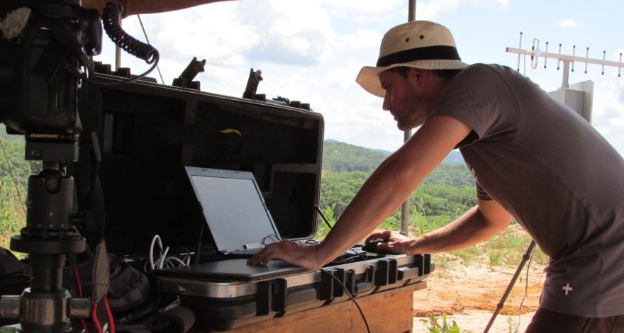
Survey-grade Mapping with a Delair UX11 PPK

11 December 2019 READ MORE The Delair UX11 PPK is a high-accuracy mapping drone. In a site with 24 checkpoints and no GCPs, it can produce maps with an accuracy under 3cm (0.1 ft).

JPB mines long-term value from adopting Delair drones for more efficient engineering services delivery

22 November 2019 READ MORE How the adoption of the Delair UX11 fixed-wing drone allowed Johnson Poole and Bloomer to increase safety and improved efficiency for gathering visual information.

INFOGRAPHIC: The anatomy of a great quarry site

4 October 2019 READ MORE All the key-steps in the functioning of a career thanks to including the latest data-driven technologies in a this infographics.
Surveying & Mapping

LATEST ARTICLES

09Jun
Delair-Tech provides UAV solution for anti-poaching

Anti-poaching operation in Tanzania

On: 9 June 2015 In: Surveying & Mapping

Read more
  • Prev
  • 1
  • …
  • 4
  • 5
  • 6
Recent Posts
  • La Région Occitanie et la Banque des Territoires réaffirment leur engagement auprès de Delair 2 December 2025
  • Delair sponsor engagé aux côtés de Jean-Baptiste Daramy pour relever le défi de l’Atlantique 7 November 2025
  • EY Entrepreneur of the Year Award: DELAIR named Occitanie Scale-Up of the Year 2025 29 October 2025
  • Delair unveils a new drone at Paris Air Show 2025 : the DT61 16 June 2025

Delair-logo
Delair, the one-stop shop for enterprise digital applications: from data collection to business intelligence
More about us

Search

Search within the website:

Free updates

Subscribe to our newsletter: Subscribe

Legal Notice

Privacy Policy

© 2020 Delair. All rights reserved.