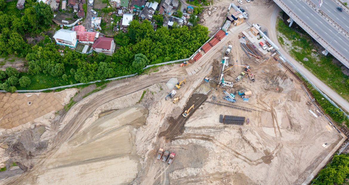
Aerial data today play a key role in the digitization strategy for construction sites. Drones, or unmanned aerial vehicles (UAVs), are part of an increasingly connected environment where machines and tools are equipped with a wide range of technological tools and sensors. The aerial and ground data merged and transformed into operational information that can be directly used by all those working on a construction site. Scanned in record time, the terrain, quarries, and structures are modelled in 3D for more accurate, cost-effective, and safe construction site progress monitoring.

Eiffage Infrastructure
In French Guiana, the rainy season— short season, then large season—lasts almost eight months. Precipitation deteriorates quarries, tracks, and construction sites, and landslides damage construction worksites. Eiffage Infrastructure’s local subsidiary—specialised in roads, sanitation, and civil engineering— acquired a Delair DT18 HD PPK UAV to:
- Obtain regularly accurate and reliable photographs of the progress of its work sites, particularly in the critical earthworks phase
- Analyse the condition of the quarries and tracks to identify those in bad conditions that might slow down or damage the machines
- Introduce a high degree of precision and ensure the capacity to respond rapidly and efficiently at all locations
Far from replacing land surveyors, the objective of using a UAV is to cut down the time and cost of the usual topographic data collection, along with the benefits of increased data reliability and accuracy.
Jérémy Moreau, manager of the topography department at Eiffage Infrastructure in French Guiana, explained:
As the first ones on the work site, we collect the necessary data to design the construction operations’ plans. Constraints from the terrain, modelling of surface water flows, positioning of the structural components, are some of examples that explain why our job requires the ability to react rapidly and efficiently
The Delair DT18 HD PKK topography and inspection UAV is ideal for digitizing large zones, hard-to-reach natural areas, and hazardous or complex sites. Equipped with high-resolution RGB sensors, it produces geo-referenced orthophotos and very high-precision 3D digital surface models.
Large amounts of data collected in a few minutes are then analysed and used for decision-making at the construction sites:
-
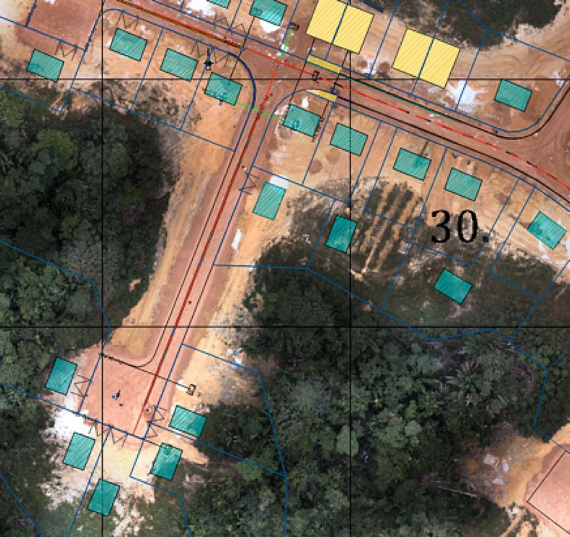
Key: Overlay of the orthomosaic map with the project plan
Orthophotos: the orthophotos produce a 2D map with spatial resolution up to 2 cm/pixel and centimetre-level precision thanks to the UAV’s on-board post-processing kinematic (PPK) system. The orthomosaic map is then integrated into the geographic information systems (GIS) to draw up the layout plan for the structural components. After the first machines have got to work on the site, the orthomosaic map make it possible to check if the work complies with the project plan.
- 3D digital surface models: these can be used to obtain elevation profiles and cross-sections. They also allow volume calculations to measure slopes to manoeuvre construction machines, calculate the volumes of earth to be filled in or excavated, or measure the quantity of material stored or to be move
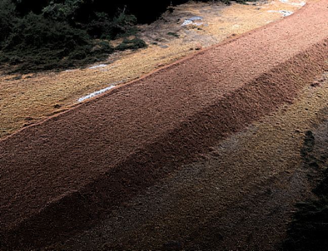
Key: Screenshot of a point cloud image (fill area)
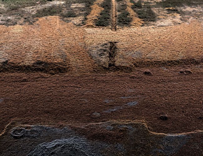
Key: Screenshot of a point cloud image (ditch)
Jérémy Moreau: “Our job is based on collecting, using, and analysing data from the field. Surface modelling and volume calculations are essential for our risk assessments and they enable us to optimise earth movements. The UAV is a non-invasive solution that allows me to take a snapshot of a construction site and take advantage of up-to-date information on the volumes of material moved to optimise machine use.”
The 3D models will then be shared on a web platform and can be used by all those involved in a project. “These days, data analysis and the capability to share this information are strategic factors for winning a project,” said Jérémy.
your construction business