SUCCESS STORY
Topography with drones for railway construction
THE CUSTOMER
The Bolloré Group has been engaged in logistic and transportation infrastructure activities in Africa since 1927. Bolloré Africa Logistics is present in 56 countries through 250 subsidiaries. Bolloré Africa Logistics is the biggest transport and logistics operator in Africa with 46 subsidiaires.

THE NEED
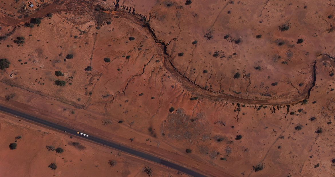
Bolloré Africa Logistics began construction of a railway in Niger between Niamey and Dosso to appease its logistical requirements. The company urgently needed to start a preliminary topographic study on the construction of the railway on an area of land measuring 150km by 500m wide. Bolloré Africa Logistics required centimetric resolution and mapping accuracy down to 15-20cm. The company also required that this entire job be completed in a maximum of 2 weeks, including all image processing.

THE SOLUTION
Delair advised employing its DT18 HD drone package equipped with the fully-integrated, survey grade RGB camera and its long range antenna to perform BVLOS flights. Equipped with this sensor, the DT18 airframe performed the mapping of the entire railway corridor. This full solution was chosen based on the high endurance of the DT18 UAV, cost-effectiveness, and ability to not only quickly acquire the data but process it accurately by leveraging the power of the Delair cloud based platform.
THE OPERATION
The Bolloré Africa Logistics project used a DT18 HD UAV system to accomplish the mission and the drone flew for 4 days to acquire the images needed to generate the results. The final product included an orthomosaic with a 4cm image resolution (GSD). An area the size of 150km long by 500m wide, the equivalent of 7,500 hectares, was mapped. Thanks to the endurance of the DT18 the acquisition was successfully achieved in a record time for this kind of project.
DATA ANALYSIS & DELIVERABLES
Putting the data to work. After 4 days of flights, the data was uploaded to Delair’s platform, which carried out the final data processing to extract the required information for the completion of the client’s first topographical studies:
• Creation of the large, continuous 2D orthophoto with a GSD of 4cm
• Creation of a point cloud with 15-20cm geo-referenced precision
• Extraction of digital terrain (DTM) and surface model (DSM) maps in CAD-compatible formats (.shp .dxf ) for conducting topographical studies
A report that includes the orthomosaic, point cloud, DTM, and DSM maps was delivered. A web visualization tool for viewing and archiving past results was created through the Delair platform. Delair also ensured the required integration of the data into the client’s own GIS/CAD software.
BUSINESS BENEFITS
- The endurance & long range of Delair’s solution made this project economically possible (7 500ha mapped in 4 days )
- Results obtained in 2 weeks vs. 3 months with traditional methods
- Price was 3 times less than traditional on-the-ground methods
- Resolution & precision beat industry standards for linear construction projects
WHY DID THEY CHOOSE DELAIR?
The endurance and long range communications enabled by Delair's technnology
Rapid solution for long linear construction projects
Cost-effective solution for large topography projects
Integrated solution for topography that enables the reduction of operational costs