SUCCESS STORY
High altitude topography with drones
THE CUSTOMER

KPWP is a British consulting group advising young and innovating companies seeking to build strong and sustainable brands. KPWP relies on a strong and global network of highly qualified experts.

THE NEED
KPWP’s client needed a feasibility study on renovating and developing The Meije Ski Resort, a famous and large resort in which the most daring skiers can truly fulfill their passion. Extending between the 3600-meter high Dome Lauze (the top of the resort) and the 1500-meter base in the village, The Meije is also one of the world’s longest ski run. Internationally renowned, Meije valleys gather, each year, passionate skiers and snowboarders from all over the world. This is Europe’s mecca for freeride skiing. Delair was hired to map the resort to plan its maintenance and enhancement.

THE SOLUTION
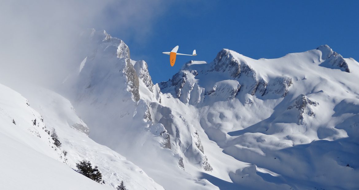
High altitude, strong wind, low temperatures, steep slopes, large area… The obstacles were various. To take up the challenge of mapping such a complex area, Delair deployed the DT18 HD long range UAV. Over a 7 km’s long slop, the DT18 flew remotely piloted beyond visual line of sight (BVLOS). The high endurance of the DT18 HD allows operators to capture thousands of RGB (Red-Green-Blue “classic eye vision”) images in a single flight. In next to no time, the images were extracted and uploaded to the Delair cloud based processing platform. A few hours later, KPWP received a unique, georeferenced and precise orthophoto of The Meije valley.
THE OPERATION
To achieve the mission of mapping in these extreme conditions of height, wind and temperature might seem risky at first. However, the DT18 HD system worked flawlessly. Even at 3 600 m, above glaciers and eternal snow, the DT18 remained stable, compliantly sticked to the flight plan and carried out its mission. A small adjustment in settings allowed the sensor to tackle the over exposure created by the snow. Another challenge on this mission was to find a landing location as the site did not offer any path of sufficient breadth. Nevertheless, the geolocation system was so accurate that landings were smoothly executed. Thanks to these combined features, the mission was executed with ease.
DATA ANALYSIS & DELIVERABLES
Processing all this data would have been impossible if Delair did not have the relevant tools and algorithms to process these kind of images. Indeed, it is difficult to identify matching points on snow covered terrain and it is a considerable challenge to build a precise DSM for such steep landscape. Despite the great challenges, the project was carried out efficiently without issues and the results were handed over to the client 48 hours following the data acquisition flights.
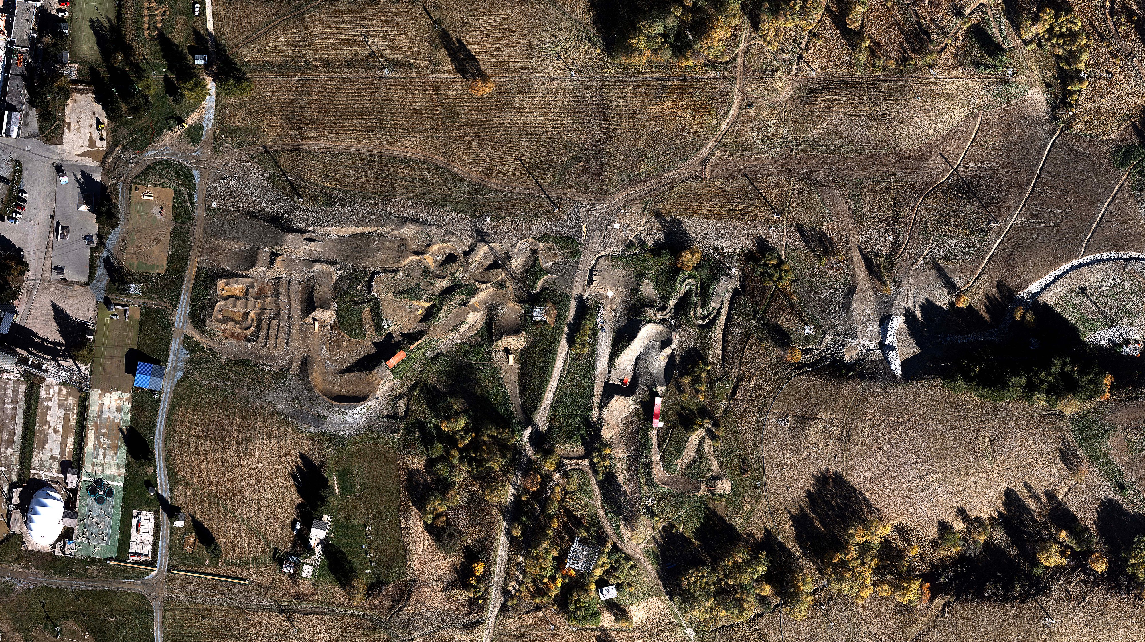
From the thousands of RGB images captured during the flights, Delair created a unique 4 cm resolution orthophoto of the skiing area. This is 200 times more accurate than what a satellite could have provided for KPWP. Thanks to a dozen control points set up on the mountain slopes, the final results were enhanced to deliver a precise DSM to the final-user.
BUSINESS BENEFITS
- Accurate results despite difficult terrain
- End-to-end solution, delivering actionable insights
- Reactive team of experts for demanding use cases
WHY DID THEY CHOOSE DELAIR?
Professional UAV system
Delair’s DT18 UAV is the best solution for demanding missions in extreme conditions
Versatile, easy to deploy solution
The DT18 UAV is an easy-to-deploy system that can be launched by hand in confined areas