How Artificial Intelligence helped improve sanitary logging in forests infested by bark beetles
While sanitary tree cutting is a normal activity for forestry operators, the spread of bark beetles that started to kill a massive number of trees was a significant challenge for the Forestry Club de France. To preserve the maximum amount of revenue, the forestry managers used aerial imagery and Artificial Intelligence to accurately target and cut only the areas at risk.
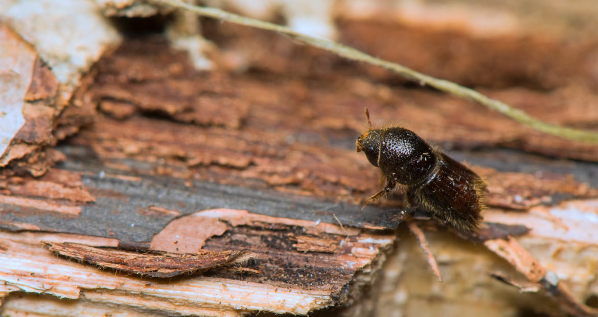
A forest threatened by a bark beetle attack
The Forestry Club de France is responsible for managing the Saint Brisson community forest located within the protected Le Morvan area in Bourgogne, France.
30 Ha (74 acres) of the forest plot was infested by bark beetles, which were rapidly spreading. The rise of bark beetles has increasingly been a problem in Europe, North America and Siberia.
The forest manager needed a precise evaluation of the damage to the forest in order to execute localized cuttings.
“We wanted to find an alternative to the current method, consisting of clear cutting very large areas even if the infestation was localized in only a few separate and specific areas.”

Satellite data obtained through European Space Agency (Sentinel) delivered the first level of assessment, with large dark spots of dead trees, but the exact location and degree of infestation were missing.
Forestry Club de France turned to Delair for their expertise in Visual Intelligence to detect and cut only the necessary areas to sanitize the forest. This includes drones along with implementing an AI-driven platform.
Step 1 for AI-driven sanitary tree cutting: Quality data collection and aggregation
Forestry Club de France started gathering accurate data by flying a UX11 AG fixed wing drone, mounted with a Micasense RedEdge MX multispectral sensor, over the forest plot. Because the evaluation targeted resinous trees, the first flight was performed in the winter so deciduous trees could be discarded (due to the fact they didn’t have leaves at this time of the year).
The drone imagery was uploaded to a processing platform to build an accurate multispectral orthomosaic using the cloud platform’s embedded photogrammetry engine
RGB map of the Saint Brisson forest in AI platform
Ground observations were also performed and gathered in a simple Excel spreadsheet. Satellite data, drone imagery and ground truth data were all combined, making the platform the single source of truth for Forestry Club de France, thus allowing further AI-based analysis on the spruce forest.
Step 2 for AI-powered sanitary tree cutting: Forest inventory and tree health mapping using Visual Intelligence
To precisely target areas that were suffering from bark beetles, the forest manager generated a complete inventory and health diagnosis. The platform made it possible to delineate the resinous tree crowns as well as separate dead and stressed trees from healthy trees.
Forestry Club de France deployed their own customized model, based on a combination of MCARI2 (living trees in green) and NDRE (dead trees in red) indices. The algorithm executed unsupervised classification, doing the heavy lifting of sorting trees into categories that allowed the forest manager to assign tree health status: stressed, very stressed, healthy and dead.
Tree height was also calculated by subtracting the crown height (captured with drone) from ground level (Digital Terrain Model computed from satellite data).

Automated tree crown detection and health assessment results in AI platform
In addition to health status categorization, these solutions acted as a powerful visualization tool by allowing forestry managers to access the following attributes for each individual tree with a simple click on the corresponding tree crown:
- H : Tree height
- S : Surface of the crown
- V : 3D crown volume
- ID_Total : ID per tree
- NDRE statistics at the tree level
Step 3 for AI-driven sanitary tree cutting: Visualize and decide where to cut
Once the platform revealed where the infestation of bark beetles had the most impact, it was possible for the forest manager to estimate the volume of wood to be cut for yield prediction purposes.
A common circle sampling technique, used in large forests, assumes there is a correlation between tree crown and trunk size. The forestry manager selected several 10m radius samples throughout the forest to build the database, and fine-tune the formula linking the two key parameters with real ground data.
Predicted clear-cutting areas based on timber volume of stressed tree per Ha in AI platform
Once the ground data was collected and uploaded, the forest manager extrapolated the results by taking the tree height as input to get a very precise estimation of the timber volume throughout the stressed areas.
Based on this estimation, the forestry manager was able to decide where to operate the clear-cutting and delineate them on the digital twin. This process provided a clear methodology for finding the right balance between preserving trees for future revenue and limiting the infestation.
A sampled forest area in a software which included tree ground data to improve the timber evaluation model
Once clear-cutting areas were identified, Forestry Club de France could share more accurate data with the forest owner and potential buyers, making high-performance drone-based solutions a significant improvement over traditional methods.
Why drone-based solutions are the right ones:
- Capability to aggregate multiple data sources and formats (satellite imagery, drone multispectral imagery, field observations) into one single source of truth that can be manipulated by the application layer
- User-friendly visualization of geospatial data with collaborative features for all stakeholders involved
- Capability to integrate and run custom algorithms, such as timber volume calculations
- Machine learning can integrate results for future iterations
With aerial imagery, instead of cutting the whole forest plot blindly like we did before, only 35% of the forest area had to be sacrificed to mitigate the risk of bark beetle infestation. We are able to limit the impact on future harvests and revenue.
It goes without saying that drone data collection is by far surpassing traditional ground inspections in terms of quantity and quality. Five-band sensors that see what the human eye can’t (Red Edge, Near Infrared, etc.) provides more and better data, enabling forest managers to harness Artificial Intelligence for more accurate and faster evaluations of the impact and scale of the bark beetle infestations.
By using an AI platform at the heart of decision making, potential revenue is preserved for the future. Only the very minimum quantity of wood was sold by Forestry Club de France at a low price, when the market is flooded with dead trees infested by Ips typographus. The rest of the forest is preserved and will be sold when the price is expected to come back to higher levels.
Aerial imagery and Artificial intelligence have made the digital transformation of forest health diagnosis a positive reality for Forestry Club de France forestry managers.