
Boost your mapping productivity with a fixed-wing drone
Long flight autonomy to map large areas
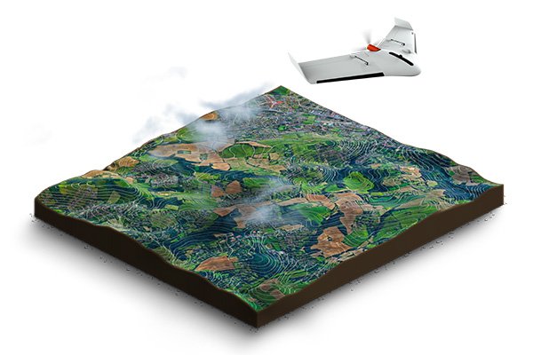
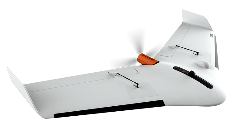
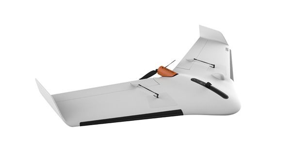
The UX11 is very productive thanks to its 80 min flight endurance combined with long flying range (53 km/33 mi). No need to sacrifice resolution for productivity when you can have both. In one single flight, you can map 300 ac / 120 ha at 400 ft / 120 m and get a 1.7 cm GSD.
Dual communication systems to fly farther
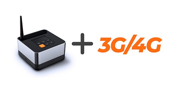
You can fly our professional mapping drone anywhere: the Delair UX11 is always connected through both a cellular connectivity (3G/4G) and a radio link with the Delair Link ground station (2.4 GHz). It's also one of only a few BVLOS-ready UAVs. Delair Link offers up to 4 mi / 6.4 km range in FCC regions and 2 mi / 3.2 km in CE regions.
Boost your mapping productivity with a fixed-wing drone
Long flight autonomy to map large areas

The UX11 is very productive thanks to its 80 min flight endurance combined with long flying range (53 km/33 mi). No need to sacrifice resolution for productivity when you can have both. In one single flight, you can map 300 ac / 120 ha at 400 ft / 120 m and get a 1.7 cm GSD.
Dual communication systems to fly farther

You can fly our professional mapping drone anywhere: the Delair UX11 is always connected through both a cellular connectivity (3G/4G) and a radio link with the Delair Link ground station (2.4 GHz). It's also one of only a few BVLOS-ready UAVs. Delair Link offers up to 4 mi / 6.4 km range in FCC regions and 2 mi / 3.2 km in CE regions.
The most easy-to-use professional mapping drone
The most easy-to-use professional mapping drone
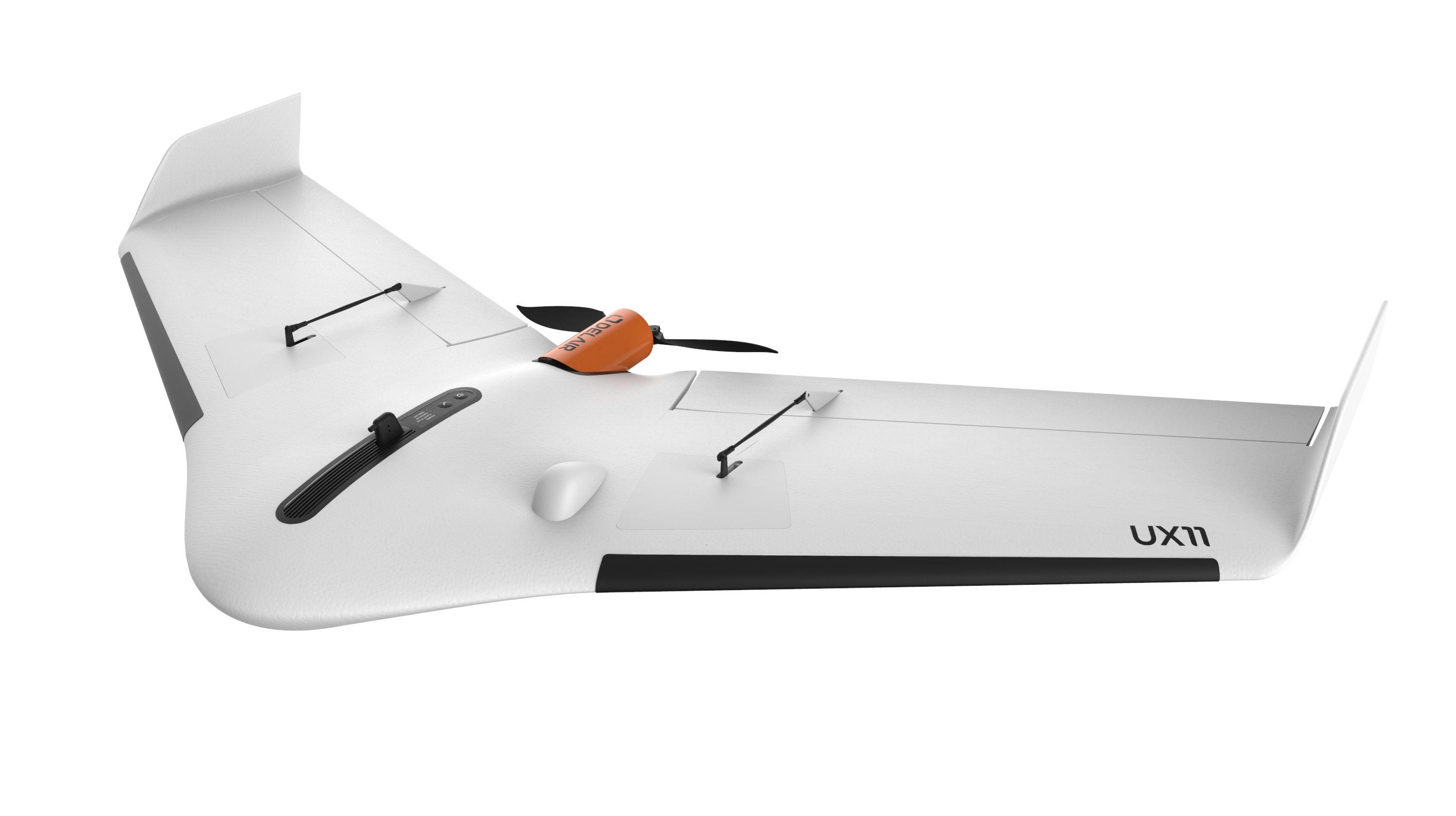
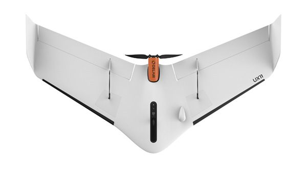
The UX11 is lightweight (only 1.5 kg) and easy to carry. It comes with a compact carrying case (43 x 36 x 80 cm) that you can easily wear on your back (13 kg).
Getting set up out in the field with the Delair UX11 is easy. You simply snap together the two wings and you’re ready to go. The drone is assembled in less than 5 minutes.
Plan your mission back in the office with Delair Flight Deck, a user-friendly software running on Android tablet. Then make your finer adjustments based on environmental conditions once you’re out in the field (wind direction). You control the UAV takeoff and landing area, direction and approach. Before the flight, run through all preflight checks still on tablet.
Takeoff is manual by hand. It’s that simple. You do not have to be a seasoned drone pilot to launch the Delair UX11. It is fully automatic. Simply plan your flight in a few clicks on a tablet with Delair Flight Deck software and launch your drone: the flight and landing are done on autopilot.
The Delair UX11 lands gently on its belly like a bird, at low speed and with great precision, using reversed thrust and a ground sensor. The UX11 can land in very small areas and complex environments (30 ° descent angle).
After landing, the Delair After Flight software (included) helps you filter, select and process raw data upon download on PC. You save readable pictures (jpg, tiff) in an automatically organized way, ready to be exported to any photogrammetry software including streamlined support for Trimble Business Center (.jxl output).
Make the most out of your drone data: the Delair UX11 comes with credits to process your data in Delair Aerial Intelligence Platform. Rapidly and repeatedly analyze imagery and turn aerial data into actionable business insights. Access your data anywhere at anytime without worrying about the infrastructure you need to process data. View, measure, annotate and share actionable data.
The professional mapping drone that delivers survey-grade quality data
Best-in class and fully integrated camera
The Delair UX11 onboards a global shutter, fully-integrated industrial-grade RGB camera designed by Delair offering 1 cm GSD imagery.
Best-in class and fully integrated camera
The Delair UX11 onboards a global shutter, fully-integrated industrial-grade RGB camera designed by Delair offering 1 cm GSD imagery.
Live In-flight image quality control
You can control camera settings and quality during flight thanks to a real-time camera to Ground Control Station radio link. In-flight and in the field quality reporting mean no more guessing if your data is photogrammetry-worthy.
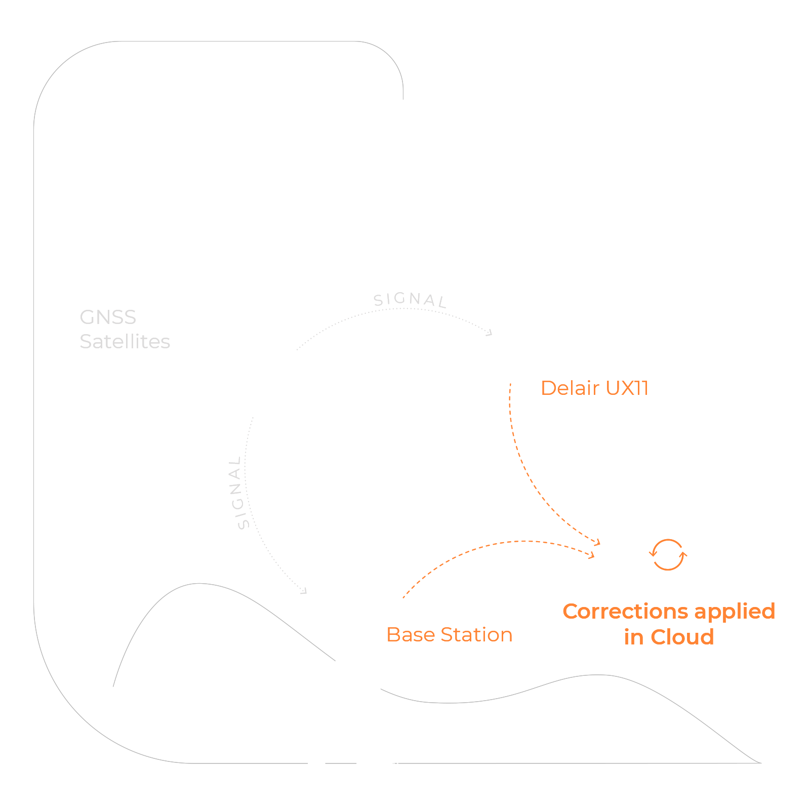
Post-Processed Kinematic (PPK) for centimeter accuracy with minimal use of GCP
Our professional mapping drone gives you the precision you need. The Delair UX11 is equipped with a dual-frequency GNSS sensor (L1, L2) and uses both the GPS and GLONASS satellite constellations. You can activate the PPK flexibly as you go: unlimited or on demand and even retroactively. Delair After Flight software (included) takes care of the PPK processing.
Delair UX11 package content
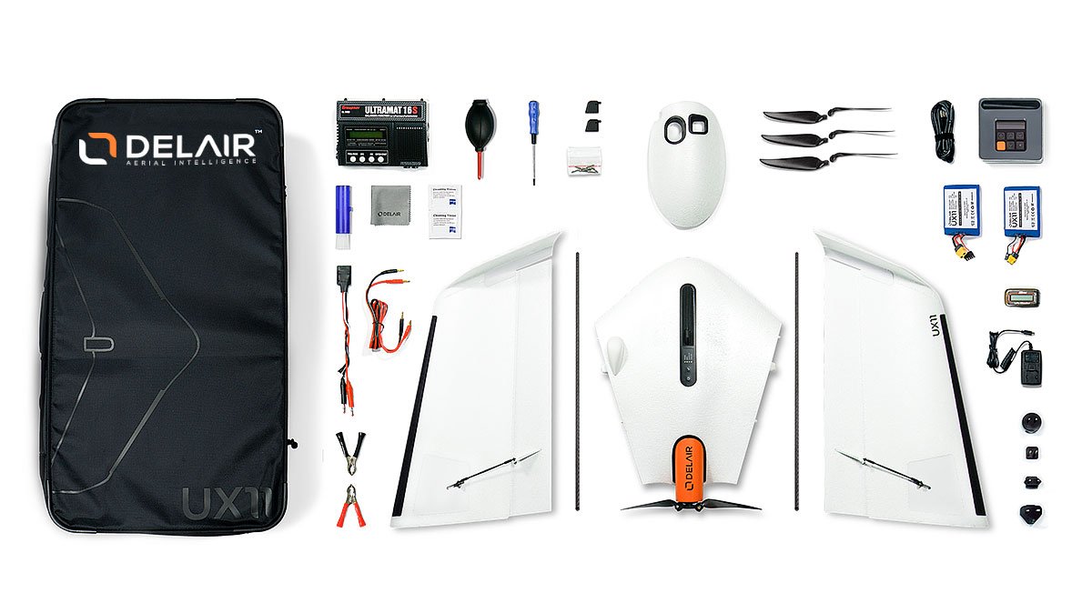
- Delair UX11 Aircraft
- Delair Link ground station with charger
- Batteries (2) and charger (1)
- Lightweight transport case (1)
- Delair Flight Deck software (available on Google Play store)
- Delair After Flight software
- 3G/4G connectivity – 2-year subscription, up to 40 hours of flight time per month included
Accessories and spare parts:
- pitot tubes (2)
- belly plate (1)
- connecting rods (2)
- propellers (3 pairs)
- propellers screwdrivers (1)
Specifications
Aircraft specifications
| Endurance1 | Up to 80 min |
| Weight (payload included) | 1.6 kg (3.5 lbs) |
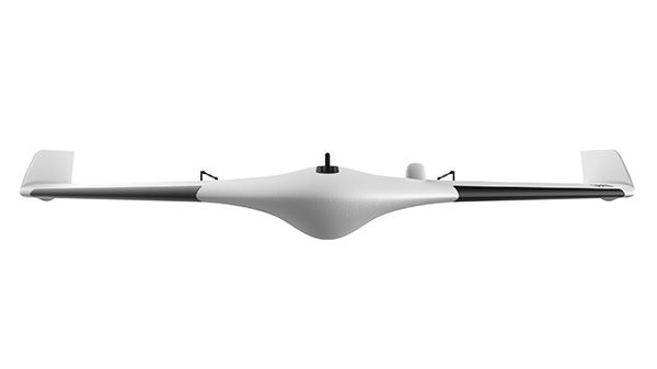
| Wingspan | 1.2 m (47 in) |
| Deployment time | 5 min |
| Cruise speed | 54 km/h (34 mph) |
| Take off / Landing | Hand-launched (angle: 30 degrees) / Belly landing (angle: 30 degrees) |
| Flying range1 | 53 km (33 mi) |
Communication range
| 3G / 4G | Unlimited (within network coverage) |
| Optional radio link1 | 5 km in FCC configuration (and up to 10 km) 3 km in CE configuration (and up to 5 km) Battery life of GCS from 6 to 10 hours* *(depending on env. conditions) Encryption AES128 |
Sensor
| Image Resolution | 21.4 Mpix |
| Sensor type | CMOS sensor, global shutter, distortion free |
Operating conditions
| Weather | 45 km/h (28 mph) wind resistance, moderate rain |
| Maximum tested altitude (MSL) |
Takeoff at 5,000 m (16,400 ft) Flight at 6,000 m (19,700 ft) |
Delair UX11
THE PROFESSIONAL MAPPING DRONE:
SURVEY AND MAP WITH EASE
Datasheets
(1) Actual results of the Delair UX11, the professional mapping drone, may vary depending on UAV configuration, battery age and condition, and operational, environmental and climate conditions.
Specifications subject to change without notice to improve reliability, function or design or otherwise.
© 2019, Delair SAS. All rights reserved. Delair is a trademark of Delair SAS, registered in France.
All other trademarks are the property of their respective owners.
Specifications subject to change without notice to improve reliability, function or design or otherwise.
© 2019, Delair SAS. All rights reserved. Delair is a trademark of Delair SAS, registered in France.
All other trademarks are the property of their respective owners.
Enhance your mapping drone
See the replay of our webinar to learn more about our three new features
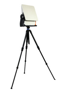
The Delair Xtended Link
A new telecommunications antenna that extends your range up to 25 km
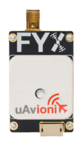
On aircraft ADS-B modules
Both ADS-B in and out options giving you sense and avoid technology to help enable flights in more airspace
To go further
Features, payload, data… find all the answers to your questions
Find out how the Delair UX11 would perform on your project
Let's talk
Contact us for a one-to-one discussion and free quote
with one of Delair’s drone specialists
with one of Delair’s drone specialists
(All fields are required except for the optional "message" and "phone" fields)
