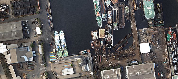
Every geospatial project starts with a well-defined scope. Within that scope there is inevitably a plan for how the data to be analyzed will first be collected. Data may be pulled from existing sources or it may need to be acquired from new. And every new data collection project calls for the right mapping technology. Surveying with drones has advanced in recent years to the point where it is now proven to be an effective and efficient method for acquiring geospatial data. Drones can benefit geospatial projects of various scopes by offering a unique perspective and rapid turnaround of data.
Photographic mapping with drones: how does it work?
Modern drones are becoming more and more capable of carrying payloads which include a variety of sensors such as cameras, multispectral sensors, LiDAR sensors, thermal cameras, and more. When it comes to most geospatial applications, three-band (red/green/blue or RGB) cameras continue to lead the way as the sensor of choice. When mounted on a UAV, the camera becomes the key element of the unmanned aircraft system (UAS, suggesting that the aircraft alone is only one component of a system tasked with a mission).
The ground control station (GCS), is used by the pilot who, in a mapping application, will generally use software to program the drone to follow an automated flight plan. In photogrammetric applications, this is generally a “lawn mower” pattern or a series of parallel linear flight paths that guide the drone back and forth while autonomously triggering the camera at set intervals or locations. Mission planning software takes into account the specifications of the camera (sensor size, focal length, etc.) and flight metrics such as airspeed and altitude to ensure that the flight lines are close enough to each other to ensure that the footprint of the ground appearing in each photograph has some overlap with adjacent photographs. Following the flights, these individual photographs will be “stitched” together to create one large mosaic image that is georeferenced, often referred to as an orthophoto.
Resolution & accuracy: how to evaluate your data set?
The goal of UAV photogrammetry is generally to achieve high resolution aerial imagery. The resolution in this case is referred to as the ground sample distance (GSD) which is essentially a measure of how big of a footprint on the ground is represented by one pixel in the orthophoto. For example, aerial maps collected by a small drone may have a GSD of as precise as 1 cm (i.e. one pixel in the image represents an area of the ground that is 1 cm x 1 cm square), whereas a manned aircraft photogrammetry survey may produce imagery with a GSD of around 15 cm or more and satellite imagery can range from around 30 cm on the high-end (very expensive) to 30 m which is more typical.
Another critical aspect of evaluating the quality of a dataset is in assessing the accuracy of it. In this case, accuracy can be either relative or absolute. In the geospatial sense, relative accuracy suggests that if you were to take the location of one feature in the image and measure its distance from another feature, that the distance and relative position between the two features would be correct. However, the actual geographic coordinates of both locations could be far off from actual. Absolute accuracy in the geographic sense suggests that for any given location within the dataset, it can be relied upon that the calculated coordinates of that position are within a given measurement from the true coordinates, if one were to know that position with absolute certainty.
Aerial imagery collected from a drone may generally be highly precise but it is not always highly accurate. Experienced surveyors or geospatial professionals will employ the use of ground control points (GCPs) or will use drones equipped with dual-frequency GNSS receivers that are PPK-enabled for highly accurate georeferencing of the aerial data. PPK-enabled drones may be able to achieve as good as 2-3 cm accuracy horizontally and around 5 cm vertical accuracy. The scope of the project will determine what is truly needed and the equipment selected along with the operator’s experience will determine the accuracy that can truly be achieved. Ultimately, the photogrammetry dataset will become input data for analysis which will ultimately yield the geospatial intelligence being sought after.
