SUCCESS STORY
Emergency mapping with drones for collapsed mine structures
THE CUSTOMER
Copernicus is a European Earth Observation Program. Delair is the UAV company officially selected by the European Commission for a four-year pilot project to assess the potential role of unmanned aerial platforms in emergency situations.

THE NEED
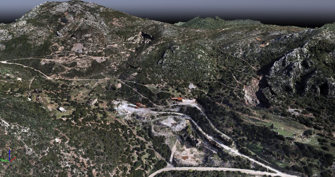
The Acquaresi mine is one of the most closely monitored sites in Sardinia. With the closure of the mine more than 10 years ago, following the gradual rise of the water table to 90 m above sea level, there was a sudden flooding of the mine voids, with an intensification of instability phenomena, including the collapse of the roof. The results were often observed at the surface, with the appearance of sinkholes and extensive fractures above the main galleries. The area is considered very dangerous and not easily accessible. A UAV flight is an ideal solution for surveying the area every 3 months without putting surveyors at risk

THE SOLUTION
Taking advantage of its 2 hours of autonomy and BVLOS certification, the DT18 UAV makes a terrestrial survey of the 10 km² safer and quicker. The sensor is mounted inside the DT18 fuselage and the operator can control the autonomous flight from the Mama Bear ground control station over a 20 km range. Data can normally be acquired even in windy conditions (45 km/hour). The UAV follows the Digital Terrain Model and adapts its altitude to remain at 120 m above the ground in this mountainous area, to comply with Italian regulations. During the flight, the operator also has the possibility of collecting several Ground Control Points (GPCs) that can be integrated in the data processing phase to reach a level of accuracy to the nearest centimeter.
THE OPERATION
Only three DT18 HD flights were necessary to cover the entire area of 10 km². The operator was on site at 8.30 am and completed the survey at 2.00 pm after collecting 7364 RGB in total and 16 GCPs with a GNSS station as required by the Copernicus program.
DATA ANALYSIS & DELIVERABLES
In order to reduce the number of images to be processed and optimise the data-processing time, Delair’s proprietary DL Tool application was used in the early data-processing phase. DL Tool applies different filters to keep only the raw images that are important for the photogrammetry process. From 7364 raw images initially, the dataset was reduced to 5318 images.
The automatic photogrammetry process was then initialized to generate the deliverables 48 hours after data collection in Sardinia.
The RGB and multispectral georeferenced orthophotos were created with 10 cm Ground Sample Distances (GSDs), a Copernicus requirement, 100 times better than the performance of a satellite could have provided for this area in the time. The georeferencing was improved thanks to the integration of 16 GCPs to reach 8 cm accuracy and generate a high-quality DSM to study the evolution of the terrain every 3 months.
BUSINESS BENEFITS
- Easy to deploy and versatile solution for mapping remote zones
- Advanced and certified UAV for BVLOS flights
- More reactive and greater resolution than a satellite
WHY DID THEY CHOOSE DELAIR?
Most advance solution
Delair’s DT18 UAV is the most advanced solution for the most demanding and critical mission.
Very high spatial resolution
The European Commission selected Delair to demonstrate the potential role of unmanned aerial platforms as a complementary source to post-event satellite imagery in emergency situations requiring very high spatial resolution.