Drone Solutions for Mines and Aggregates
The Mines & Quarries activity involves moving earth and profitability often depends on the ability of the operational team to optimize this task while reducing costs to a minimum. In order to do that, a prerequisite is to accurately determine the volume of ground to be moved.
DELAIR UAVs are a fast and cost effective way of undertaking topographical surveys. They reduce human intervention on site, allow operations to continue during surveys, and yield engineering-grade measurements.
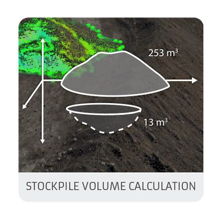
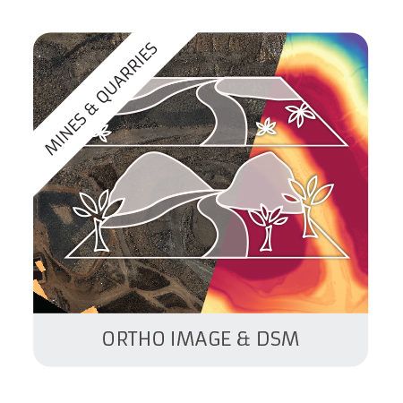
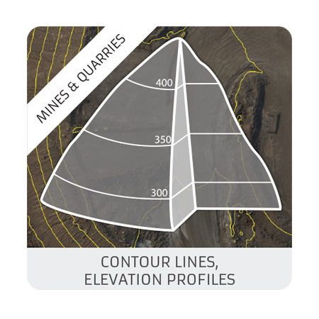
For monitoring mines and quarries, volumes of stock piles and detecting anomalies, DELAIR offers a complete range of specific products such as orthomosaics and digital surface models (DSM) accurate to within one centimetre, contour lines and stock pile identification with corresponding volumes calculated.
Our products
Benefits
- Minimize human intervention for maintenance operations in remote locations.
- Automatically detect and identify potential hazards from above, to stop them causing accidents.
- by eliminating the need to stop operations in the surveyed zone
- by minimizing the topography costs and times
- by providing accurate pit models and contour maps to improve planning
- by estimating stock pile volumes
Let's talk
with one of Delair’s drone specialists
(All fields are required except for the optional "phone" field)