The switch to drone technology comes with a handful of possibilities. Many power companies are now experiencing the opportunity. After defining their key issues, they reach out to drone suppliers in order to test the technology. With a wide range of payload and sensors, drones are carrying out increasingly complex operations. However, operators must understand the limitations of the technology.
- What to consider before switching to drone technology?
- What to expect from the technology and its limitations?
- What to understand about regulation and safety?
Study all possible solutions and understand the implications
Compared to ground-based systems and helicopters, drone technology provides a complementary solution to inspect the power infrastructure. While the use of Unmanned Platforms reveals to be 30 to 40% cheaper, a wide range of possible solutions still need to be assessed.
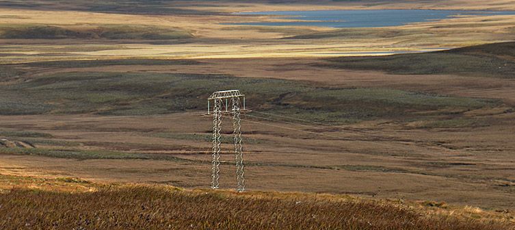
For instance, the choice of the platform varies depending on the application. Short-range platforms will be deployed to perform ‘check on the spot’ and avoid climbers to climb a pylon. Long distance drones will be preferred to collect data or geo-locate and classify anomalies. Generally speaking, Multi-rotors are better for random point inspections, while long-range drones are used for larger linear inspections.
On top of that, the choice of the Payload depends on the application. For long range operations, vegetation encroachment on power lines can be detected using LIDAR. Implementing LIDAR sensor can also optimize vegetation management operation and analyze the environment surrounding power lines.
One major capability for long-range asset monitoring is the access to a Data-Network. In June 2017, RTE and Delair have successfully completed a 50km flight via a 3G cellular Network. This major achievement in the French civilian drone industry is the first step towards making drones the most common method for large infrastructure inspection.
Another consideration before switching to the drone technology is the regulatory aspect of the operation. While the technology is still new, the French Civil Aviation Authority (DGCA) grants specific rights to use flight corridors under a defined regulatory framework. To enable this 50-kilometer experimental flight, Delair was approved to fly on autopilot using onboard data integration of its positioning in real-time.
Thus, solving a problem often requires studying all possible solutions in order to solve it
Evaluate the best solution
Weighing the risks versus benefits of the technology and how much capital to invest is key. Most customers choose to undertake drone utility programs in order to assess the best solution.
While drones are cheaper solutions than helicopters or walkers, they can be used to provide a more exhaustive description of an infrastructure, up to a centimetric detail. Also, the data can be stored and compared in the future with other acquisitions of the same type to measure the evolution.
As the technology is quickly improving, many applications can be carried out ranging from forecasting future vegetation threats to respond to disaster rapidly. Drones are definitely ahead in many solutions of the future!